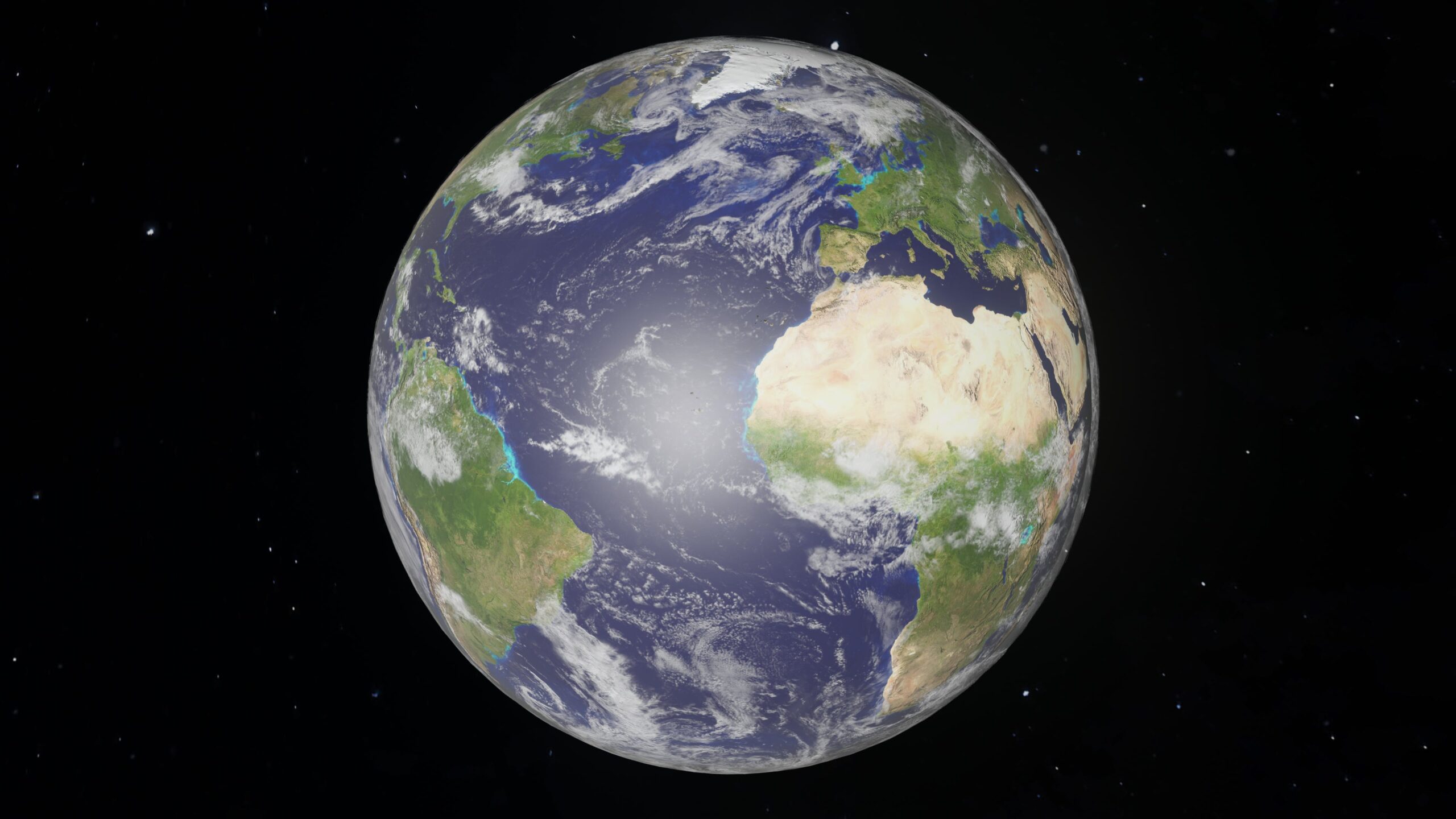
Copernicus is a program managed by the European Union andEuropean Space Agency, ESA, which is responsible for building and managing a fleet of Earth observation satellites called Sentinel. This constellation of satellites is made up of different missions, each with a specific task of monitoring terrestrial conditions. For example, Sentinel-1 is a satellite that provides high-resolution radar imagery for observation of land, sea and polar areas; its launch in the 2014 marked thestart of the Copernicus programme.
Each satellite in the constellation is optimized for a specific observation mission and collects data on various environmental aspects such as atmosphere, water, soil and vegetation. The data collected by Sentinel satellites is used in various sectors, such asagriculture, The environmental monitoring, the management of natural disasters and the control of water resources, to name a few.
Sentinel constellation, a crucial hub for Earth observation
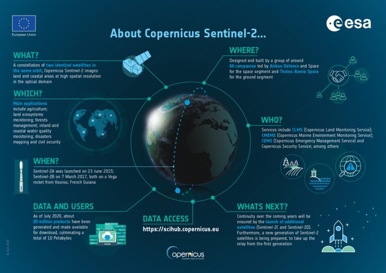
Launched between 2014 and 2020, the Sentinel fleet is made up of six different types of satellites, each with an assignment it's a'specific orbit:
• Sentinel-1: a new look at the Earth.
This satellite uses SAR (Synthetic Aperture Radar) data forobservation of the territory. Thanks to the ability to penetrate clouds and observe the Earth's surface in all weather conditions, Sentinel-1 provides valuable information for monitoring of natural events (such as earthquakes, volcanic eruptions and floods) and human activities (such as naval traffic and fishing activities).
• Sentinel-2: multispectral vision for agricultural precision.
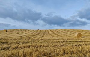
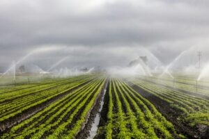
Sentinel-2 is another important satellite in the constellation, thanks to its extraordinary ability to capture high resolution multispectral images. This instrument it is particularly useful in precision agriculture, since it allows you to Accurately identify crop conditions, their health, and any hazards or stresses they may face, such as disease, nutrient deficiencies, or water stress conditions. Thanks to Sentinel-2, farmers are able to define specific strategies for each area of the field, intervening in a targeted manner only where necessary, thus optimizing the use of resources such as water, fertilizers and pesticides.
• Sentinel-3: Beyond Earth's Borders.
Sentinel-3 is designed for observe the oceans and masses of water. Using a suite of highly sophisticated instruments, including a radar altimeter, spectrometer and color sensor, Sentinel-3 provides essential data on sea temperatures, algae cover and overall water quality. This information is vital for coastal management, the surveillance of marine ecosystems and the identification of phenomena such as ocean acidification. Data from Sentinel-3 can be used to prevent coastal pollution and develop useful forecasting models to react in a timely manner to potential threats to our marine environment.
• Sentinel-4 and Sentinel-5: atmospheric science.
Sentinel-4 and Sentinel-5 are mainly concerned withobservation of the earth's atmosphere. These satellites are equipped with highly sensitive instruments that constantly monitor the atmosphere for air quality, the presence of polluting gases and the climate dynamics. This data is vital to better understand the climate changes, polluting emissions and the level of ozone in our atmosphere. In particular, Sentinel-5 provides valuable information for management of industrial, agricultural and vehicular emissions, helping to monitor air pollution and develop more sustainable environmental policies.
• Sentinel-6: sea level monitoring.
Sentinel-6 is the first satellite dedicated exclusively to monitoring of sea levels. This latest generation satellite is able to collect accurate data on sea level, detecting even minimal variations in the ocean surface. This information is of fundamental importance for understanding global climate change, predict sea level rise and take preventive measures to protect coastal areas.
A cutting-edge constellation
Each of the Sentinel satellites accomplishes a precise journey around the Earth, at a specific altitude dictated by its specific mission. On board, sensors with very high technological content they collect a variety of data: high-resolution optical imagery, cloud-penetrating radar, altimeters to measure the height of seas and glaciers, and radiometers to probe the atmosphere.
In a continuous flow of information, the raw data, acquired in different formats, is transmitted to Copernicus ground stations. There, trained experts transform them into usable products, such as georeferenced images, thematic maps and detailed graphs. A real treasure of information that is freely shared with the whole world throughCopernicus online data hub.
Let's explore in detail the operating principles of this constellation.
Orbit
The orbital position of each Sentinel satellite is determined by its specific mission. Sentinel-1 and Sentinel-2 orbit in tandem, ensuring complete coverage of the Earth every 6 days. Sentinel-3 sits on an inclined altimetric orbit, offering a full view of the planet every 27 days. Sentinel-4 and Sentinel-5 position themselves in geostationary orbit, allowing continuous monitoring of the atmosphere. Sentinel-6 orbits in tandem with Jason-3, an altimetry satellite, to improve the accuracy of sea level measurements.
Data acquisition
The onboard sensors of each Sentinel satellite are designed to acquire specific data. Sentinel-1 uses a synthetic aperture radar (SAR) to map the Earth's surface in all weather conditions. Sentinel-2 is equipped with a multispectral optical sensor which acquires high resolution images of the terrain and vegetation. Sentinel-3 combines optics, radar and altimetry to measure oceanic and atmospheric parameters. Sentinel-4 and Sentinel-5 use spectrometers to monitor atmospheric composition. Sentinel-6 employs a radar altimeter to accurately measure sea level.
Data transmission
The data acquired by the sensors are transmitted to the Copernicus ground stations via X-band connections. The network of sland tations it is distributed all over the world to ensure efficient data acquisition.
Process and storage
The raw data is subjected to a processing process that includes radiometric corrections, calibration and georeferencing. Final products, such as images, maps and graphs, are stored in an accessible database.
Data access
Copernicus data is freely accessible to all users via the online data hub. The Data Hub offers a user-friendly interface for searching, viewing and downloading data.
In conclusion, the Sentinel satellites represent a world-class Earth observation system. Their advanced technology, combined with lFree and open access to data, allows you to monitor our planet with unprecedented precision. Sentinel data is used for a variety of applications, fromprecision agriculture to the climate change monitoring, from security to defense. Thanks to this constellation of space sentinels, we can learn more about the Earth and build a more sustainable future for our planet.


Add comment
You must be logged in to post a comment.