When talking about precision agriculture, the risk is that of telling it only through the instruments: maps, vegetation indices, satellite data, environmental models, digital platforms. All fundamental elements, of course, but which alone do not really explain the value of a technology if they are not related to the decisions that that technology must make possible.
For this we have built a new page dedicated to TETHYS solutions starting from the recipients, even before the services. Because a Land Reclamation Consortium, an insurance company, a agro-industrial group or an operator agrivoltaic They don't seek the same answer, even when they use the same monitoring system. Responsibilities change, the scales of intervention change, the data to be observed change, and Above all, the way in which that information must be transformed into operational choices changes.
Our solutions are aimed at alarge audience:
• Land Reclamation Consortia
• Experts and insurance companies • Agribusiness
• Agrivoltaic plant managers
• Manufacturers and distributors of
machinery and inputs for agriculture
• Public bodies and research institutions
• Agronomists and business consultants
• Producer associations
• Golf club and greenkeeper
Precision agriculture becomes really helpful when it comes in concrete processes: consortium water management, damage assessment, supply chain planning, monitoring of agrivoltaic systems. This is the direction in which TETHYS works, offering a flexible, customizable system capable of adapting to different interlocutors, keeping a fixed point: making what happens in the fields readable through objective, updated and comparable data over time.
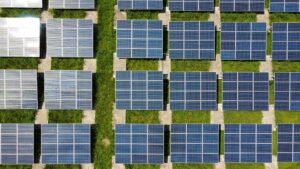
Agrivoltaics: documenting agricultural continuity over time
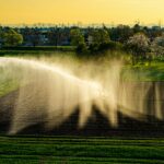
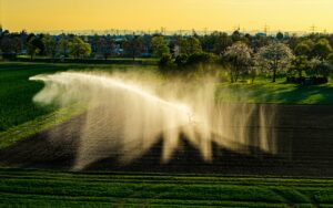
Agrivoltaics is one of the areas in which the need for objective data appears more evident, because the coexistence between energy production and agricultural activity must be designed, managed and documented throughout the life cycle of the plant. agricultural continuity, in fact, cannot be considered only an initial condition to be described in the authorization phase, but must be able to be observed and demonstrated over time, season after season.
TETHYS supports owners and managers of agrivoltaic plants through satellite monitoring tools and environmental models that allow read the vegetative state of crops, estimate irrigation needs, observe production trends, and collect useful information for the technical documentation required by advanced agrivoltaic projects. In this way, the data becomes an element of continuity between planning, agricultural management and results verification.
For those who develop or manage agrivoltaic systems, this means to be able to demonstrate more solidly that agricultural activity remains an integral part of the system and that energy production is inserted into a real, monitored, and measurable agronomic context. The goal is not to declare an abstract compatibility between panels and crops, but build over time technical evidence capable of supporting the quality of the project.
Land Reclamation Consortia: From Distributed Water to Measured Water
For the Land Reclamation Consortia, water management does not only concern the distribution of the resource, but the overall balance of an agricultural territory that must be served, monitored and governed with increasingly precise criteriaIn a climatic context where water availability is less regular and crop needs can change rapidly during the season, knowing where to irrigate, how much to irrigate and with what effects becomes a essential condition for improving the efficiency of the system.
TETHYS provides Consortia with monitoring tools based on satellite data, useful for observing the actual irrigation consumption of the consortium companies and supporting a more conscious management of water distributionThrough a customizable control panel, the Consortium can read the territory in a more orderly way, aggregate information across large areas, identify critical issues and build an objective basis for administrative management, from cost reduction to the possibility of linking consortium fees to actual water consumption.
In this context, precision agriculture goes beyond the size of the single plot and becomes a governance toolThe data is not only useful to the farmer to decide when to irrigate, but also to the Consortium for plan better, make the distribution of the resource more transparent and strengthen the relationship with the agricultural companies served.

Insurance and experts: a more solid basis for assessing damage
In the agricultural insurance sector, the damage assessment requires speed, precision and ability to to reliably reconstruct what happened before, during, and after an adverse event. The expert's work remains central, because direct observation and technical expertise are irreplaceable, but today they can be integrated with tools capable of making the process more objective, documentable and comparable.
TETHYS supports insurance companies and experts Through satellite analyses, it is possible to observe the evolution of the vegetative state of crops, identify anomalies, compare affected and control areas, reconstruct dynamics over time, and support field assessments with a broader information base. In this way, damage quantification can be based on updated and verifiable data, reducing the margins of uncertainty and making more efficient expert work.
For the insurance companies, furthermore, the possibility of having a customizable and brandable control panel It allows for more structured information organization, ongoing appraisals monitoring, and a clearer understanding of the progress of indemnified damages. Satellite data does not replace appraisals, but rather helps strengthen them by introducing a level of transparency useful to both the company and the farm.
Agribusiness: Understanding what's happening in the supply chain
For the agro-industry, the quality of the material It originates long before the transformation. It originates in the fields, in agronomic choices, in the vegetative growth of crops, in water availability, in the ability of the supply chain's supply chain companies to maintain production standards consistent with the needs of the supply chain. This is why the possibility of continuously read what is happening upstream is becoming increasingly important.
TETHYS allows agro-industrial companies to aggregate, process and compare data from different agricultural companies, offering a broader and more orderly vision of the first part of the supply chainThrough a customizable control panel, it is possible to monitor the evolution of the crops, identify any critical issues, better plan collection and processing activities, and build an information base that is also useful for objectives of sustainability, traceability and reporting.
In this context, precision agriculture becomes a support for industrial planningKnowing the fields better means reducing uncertainty, making processes more efficient and build stronger supply chains, where data helps connect agricultural production, processing and business strategies.
TETHYS solutions for your business
The new page Solutions was created to help companies, organizations, technicians and operators to identify the most suitable way to integrate TETHYS into your business as data infrastructure to support very different decision-making processes.
Today, precision agriculture should be seen as the technology that enables more informed water management, more objective assessments, more transparent supply chains, and more measurable agrivoltaic projects.