

High temperatures, increasingly irregular rainfall and periods of drought that last for weeks are changing the way of farmingIt is no longer a question of managing an occasional emergency, but of dealing with conditions that are becoming part of the norm.
In this scenario, water takes on an even more strategic valueIt is the resource that allows crops to be kept productive, but it is also the one that requires the most complex decisions. Determining when to irrigate, how much to irrigate, and how to distribute the water means finding a balance between agronomic needs, resource availability and economic sustainability.
For many years, these decisions were based primarily on experience gained in the field. Today, however, The changing climate conditions makes it increasingly difficult to rely solely on direct observationCrops respond differently depending on their phenological stage, soil type, weather conditions, and even differences within the same plot. The same irrigation that may be adequate one season may prove insufficient or excessive the following year.
Understanding how much water you really need is the real challenge
When talking about irrigation management, we often tend to focus on the amount of water available. In reality, the topic is much more complex. The question to ask is not just how much water to use, but how much water the crop actually needs at that specific moment.
Evapotranspiration, soil characteristics, precipitation, and vegetative growth continually alter plants' water requirements. For this reason, Irrigation management can no longer be based on pre-established calendars or generic assessments, but requires up-to-date and measurable information.
This is where the satellite monitoring offers a concrete contribution. Through the daily processing of environmental and meteorological data it is possible calculate the water balance of crops and provide objective information, capable of supporting more precise and informed decisions.
The kiwifruit die-off project shows how data can make a difference.
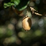
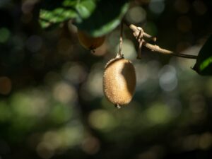
One of the most significant examples comes from research project on kiwifruit mortality, financed under the Operational Programme of the Common Market Organisation for fruit and vegetables.
During the growing season, TETHYS monitors six plots in the province of Latina and two in the province of Reggio Calabria through vigor maps and water balance analyses. The goal is not simply to observe crop development, but understand which factors can contribute to the appearance of critical issues affecting the systems.
The analyses compare the estimated water requirement with the water actually distributed by farmers on a daily basis. This information is particularly important because the hypotheses under consideration also include: the possibility that non-optimal irrigation management could favor the onset of die-off phenomena.
At the same time, satellite monitoring allows identify differences in vegetative development which are often not perceptible during normal field inspections, offering researchers and farmers additional elements to interpret plant behavior.
The same data helps manage water across thousands of hectares
The satellite information They are not only useful at the corporate level. They can become a territorial governance tool when applied on a larger scale.
This is the case of project developed together with the Consortium for the Reclamation of Spring Waters, where the TETHYS system supports the monitoring of approximately 68,000 hectares through the estimation of irrigation needs and the identification of the areas actually irrigated.
Having this information resource means plan water distribution more effectively, identify any anomalies and build an increasingly precise knowledge of the territory. An indispensable basis in a context in which every cubic meter of water must be used as efficiently as possible.
From research to everyday decisions
The thread that unites different experiences such as the kiwifruit die-off project and the collaboration with the Land Reclamation Consortia is the same. In both cases, the starting point is transform data into a decision.
For TETHYS, satellite monitoring is not only an observation technology, but also a tool to support the daily decisions of farmers, technicians, and management bodies. Knowing how crops are responding, understanding their water needs, and measuring the effects of interventions means to be able to plan field work more precisely.
Heat waves will likely continue to characterize the coming agricultural seasons. In this context, the difference will also be in the ability to use water at the right time and in the quantity actually neededThis is precisely the direction in which precision agriculture can offer the most concrete contribution.