The TETHYS system processes Earth observation data acquired by ESA satellites (Sentinel 2a and 2b) and of NASA (Landsat 8 and 9) thanks to latest generation optical sensors. The data, i.e. the acquired images, will have to undergo pre-processing regarding the atmospheric correction and the cloud masking.
How is the data acquired?
THE optical sensors they measure the amount of reflected sunlight from the earth's surface at different wavelengths.
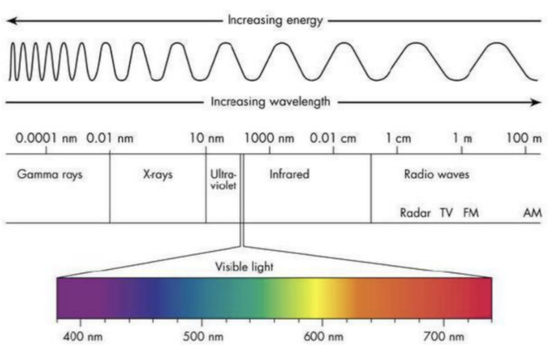
The electromagnetic radiation of the sun, on their journey to the ground and then from the ground to the sensor, they pass through the atmosphere and interact with gaseous molecules, the suspended particles and the aerosol that compose it, changing.
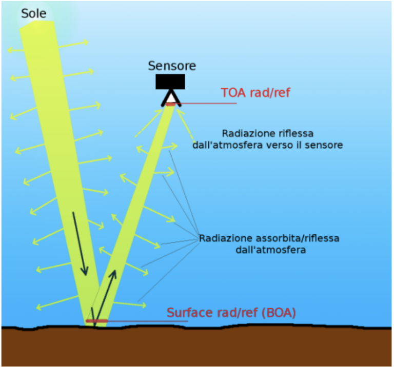
There solar radiation comes then altered as it passes through the atmosphere (absorption and scattering) and it is therefore necessary to carry out a data correction that are released by satellites before they can be processed, removing the effects of light haze, water vapor, etc. from the images.
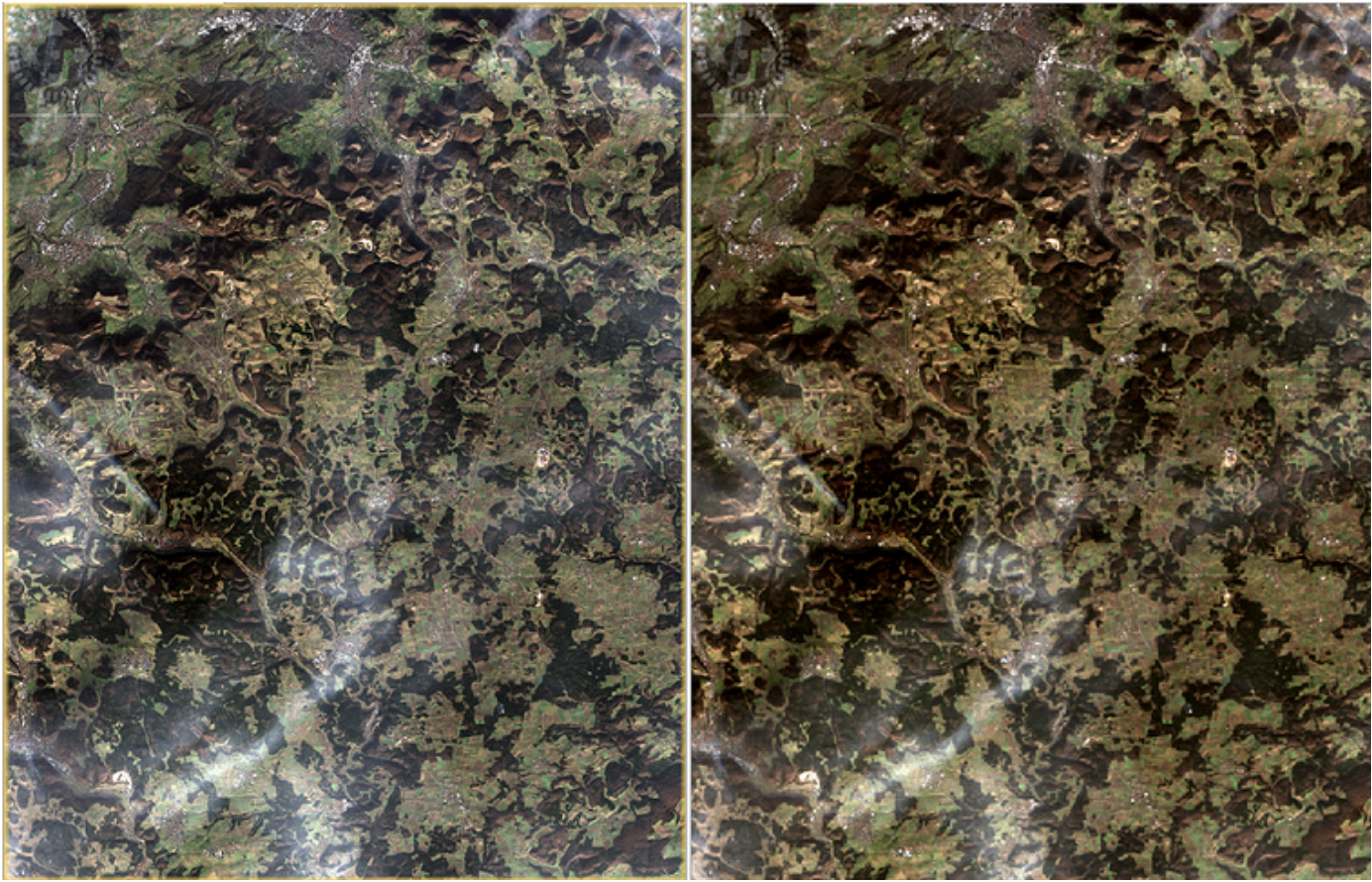
The TETHYS system carries out the atmospheric correction of satellite images using precisely him algorithms developed by ESA (Sentinel-2 toolbox; Sen2Cor) e by NASA (Land Surface Reflectance Code: LaSRC), so provide its users with always reliable and consistent processing.
Not all atmospheric phenomena can However be subjected to atmospheric correction, as in some cases (e.g. more compact and widespread cloud layers) the reflectance signal is significantly altered. It is therefore necessary to operate a pixel classification that make up an image, distinguishing those that cannot be used for processing due to clouds (in gray in the figure below on the right) and cloud shadows (in black) from those not affected by severe atmospheric phenomena (brown pixels in the figure).
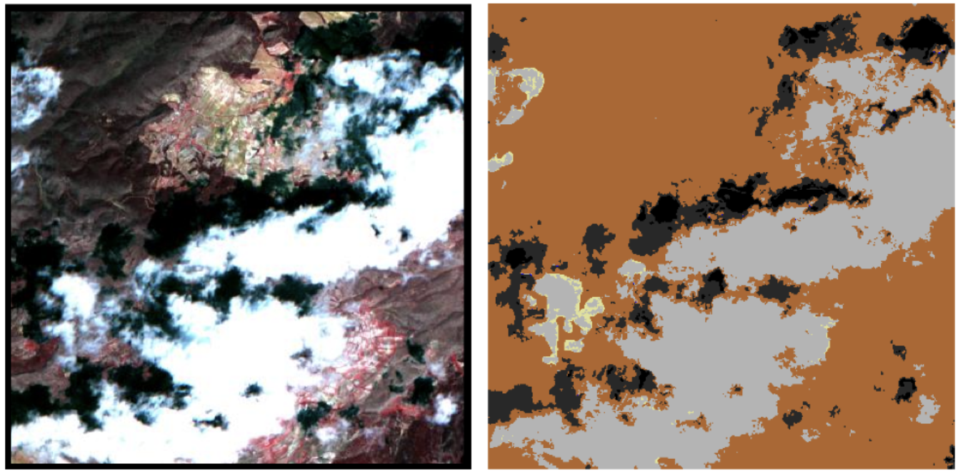
Each satellite image acquired by TETHYS is then also subjected to cloud masking (cloud masking), with i pixels identified as “altered” which are marked with gray color and not considered in the various analyses.
Even in the case of cloud-masking, TETHYS uses algorithms developed by ESA (Sen2Cor) and NASA (Fmask and ATCOR) to provide its users with always useful and reliable processing and images.




Leave a reply